ຄະນະກຳມະການ ຄຸ້ມຄອງແຫ່ງຊາດ ເພື່ອແກ້ໄຂບັນຫາລະເບີດບໍ່ທັນແຕກທີ່ຕົກຄ້າງ ຢູ່ ສປປ ລາວ (ຄຊກລ) ແມ່ນການຈັດຕັ້ງໜຶ່ງທີ່ບໍ່ປະຈຳການ, ມີພາລະບົດບາດເປັນເສນາທີການໃຫ້ແກ່ລັດຖະບານໃນການຄຸ້ມຄອງມະຫາພາກ, ເປັນຄະນະຊີ້ນຳວຽກງານ, ບໍລິຫານຄຸ້ມຄອງ, ກວດກາວຽກງານ ແລະ ເປັນເຈົ້າການປະສານສົມທົບກັບກະຊວງ, ອົງການຈັດຕັ້ງພາຍໃນ ແລະ ຕ່າງປະເທດທີ່ກ່ຽວຂ້ອງ ໃນການແກ້ໄຂບັນຫາລະເບີດບໍ່ທັນແຕກ.
ເປົ້າໝາຍລວມຂອງ ຄຊກລ ແມ່ນເພື່ອໃຫ້ປະຊາຊົນທັງໝົດໃນລາວ ສາມາດດຳລົງຊີວິດຢ່າງປອດໄພຈາກໄພຂົ່ມຂູ່ຂອງລະເບີດບໍ່ທັນແຕກ, ຊ່ວຍສົ່ງເສີມການພັດທະນາປະເທດຊາດ, ຊ່ວຍເຫຼືອຜູ້ຖືກເຄາະຮ້າຍຈາກ ລບຕ ກັບຄືນສູ່ສັງຄົມ ແລະ ຕອບສະໜອງຄວາມຕ້ອງການຂອງເຂົາເຈົ້າຢ່າງທົ່ວເຖິງ.
ສປປ ລາວ ເປັນປະເທດທີ່ຖືກຖິ້ມລະເບີດຫຼາຍທີ່ສຸດໃນໂລກ, ຖ້າຄິດໄລ່ຕໍ່ຫົວຄົນ. ຈາກການຖີ້ມລະເບີດໃນໄລຍະສົງຄາມອິນໂດຈີນ ແຕ່ປີ 1964 – 1973, ລະເບີດຫຼາຍກວ່າ 2 ລ້ານໂຕນ ແລະ ຄາດວ່າ 30% ທີ່ຍັງບໍ່ທັນແຕກ.
ສະພາບການໃນປະຈຸບັນແມ່ນ 18 ແຂວງຂອງປະເທດ ແລະ ປະມານ 25% ຂອງບ້ານໄດ້ຮັບຜົນກະທົບຈາກລະເບີດບໍ່ທັນແຕກ ໃນລະດັບທີ່ແຕກຕ່າງກັນ. ມໍລະດົກຂອງພວກເຂົາໜຶ່ງແມ່ນການເສຍຊີວິດ ແລະ ການບາດເຈັບຢ່າງຕໍ່ເນື່ອງ, ຊຸມຊົນຄົນພິການ ແລະ ຂັດຂວາງການພັດທະນາເສດຖະກິດ - ສັງຄົມ. ເປັນທີ່ໂສກເສົ້າ, ອຸປະຕິເຫດຈາກລະເບີດບໍ່ທັນແຕກ ຍັງມີຄົນໄດ້ຮັບບາດເຈັບ ແລະ ເສຍຊີວິດປະມານ 300 ຄົນໃນແຕ່ລະປີ.
ຂະແໜງການແກ້ໄຂບັນຫາລະເບີດບໍ່ທັນແຕກທີ່ຕົກຄ້າງ ຢູ່ ສປປ ລາວ ປະຈຸບັນມີອາຍຸເກີນ 28 ປີ ແລະ ກ້າວຂຶ້ນສູ່ລະດັບເຂັ້ມແຂງໃນແຕ່ລະປີ. ເຄືອຂ່າຍທີ່ເຂັ້ມແຂງຂອງລັດຖະບານ, ການສະໜັບສະໜູນຂອງສາກົນ ແລະ ອົງການປະຕິບັດງານ ຍັງສືບຕໍ່ໃຫ້ການສະໜັບສະໜູນສຸມໃສ່ຂົງເຂດຂອງການກວດກູ້, ການສຶກສາຄວາມສ່ຽງ, ການຊ່ວຍເຫຼືອຜູ້ເຄາະຮ້າຍເປັນສຳຄັນ ແລະ ການຄຸ້ມຄອງຄຸນນະພາບ, ການຄຸ້ມຄອງຂໍ້ມູນຂ່າວສານ, ການສ້າງຂີດຄວາມສາມາດນັບມື້ນັບຫຼາຍຂື້ນ. ການເປັນຄູ່ຮ່ວມງານທີ່ເຂັ້ນແຂງ ແລະ ຫ້າວຫັນກັບຫຼາຍພາກສ່ວນເຮັດໃຫ້ທຸກຄົນເຫັນປະເທດລາວມີຄວາມກ້າວໜ້າທີ່ດີໃນການແກ້ໄຂບັນຫາລະເບີດບໍ່ທັນແຕກ, ເຖິງຢ່າງໃດກໍ່ຕາມ, ສິ່ງທ້າທາຍໃນຕໍ່ໜ້າຍັງມີຄວາມຫຍຸ້ງຍາກຫຼາຍຢ່າງ.
ໃໝ່ລ່າສຸດ
ຂ່າວສານ
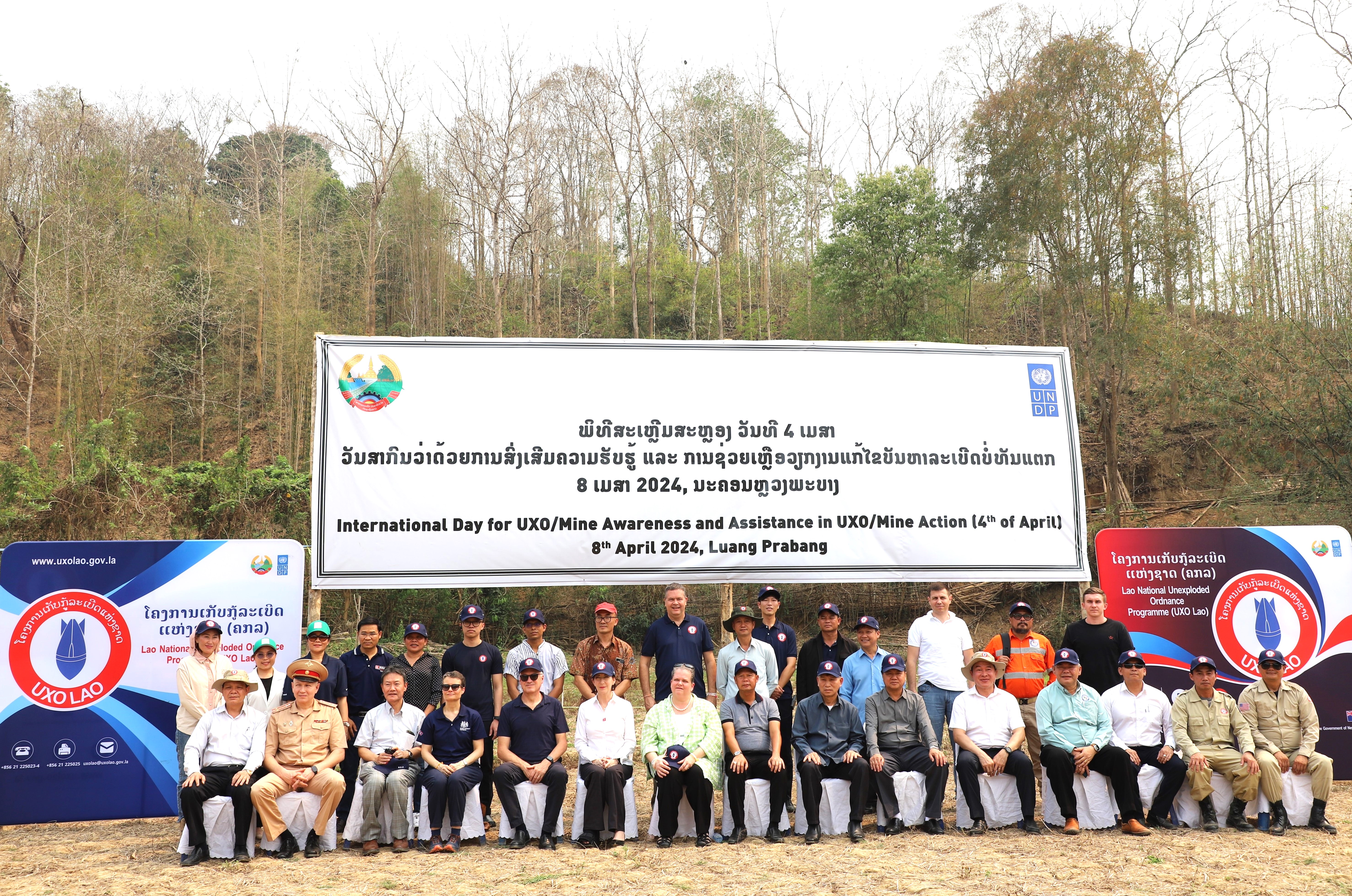
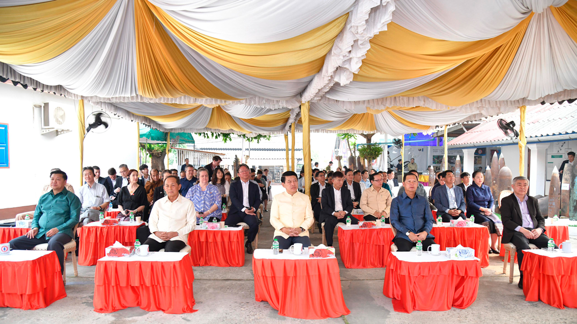
ພິທີສະເຫຼີມສະຫຼອງ ວັນທີ 4 ເມສາ ວັນສາກົນວ່າດ້ວຍການສົ່ງເສີມຄວາມຮັບຮູ້ ແລະ ການຊ່ວຍເຫຼືອ ວຽກງານແກ້ໄຂບັນຫາລະເບີດບໍ່ທັນແຕກ, 8 ເມສາ 2024, ນະຄອນຫຼວງພະບາງ
Published on 09/04/2024
ໃນຕອນເຊົ້າ ວັນທີ 08 ເມສາ 2024 ພະນະທ່ານ ສະເຫຼີມໄຊ ກົມມະສິດ ຮອງນາຍົກລັດຖະມົນຕີ, ລັດຖະມົນຕີກະຊວງກ...
ອ່ານເພີ່ມເຕີມການຝຶກອົບຮົມ ກ່ຽວກັບການຄຸ້ມຄອງຖານຂໍ້ມູນ ລບຕ ໃຫ້ພະແນກການຕ່າງປະເທດແຂວງ ແລະ ຫ້ອງວ່າການເມືອງ ຂອງແຂວງຄຳມ່ວນ ແລະ ຈຳປາສັກ, ວັນທີ 26-29 ມີນາ 2024 ຢູ່ ເມືອງທ່າແຂກ ແຂວງຄຳມ່ວນ
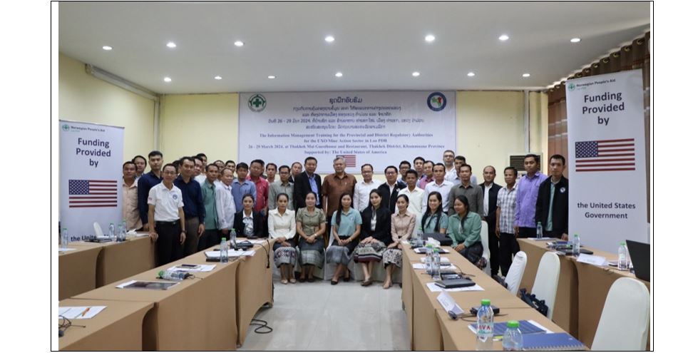
Published on 27/03/2024
...
ອ່ານເພີ່ມເຕີມການຝຶກອົບຮົມກ່ຽວກັບການຄຸ້ມຄອງຖານຂໍ້ມູນ ລະເບີດບໍ່ທັນແຕກ ໃຫ້ພະແນກການຕ່າງປະເທດແຂວງ ແລະ ຫ້ອງວ່າການເມືອງ ຂອງແຂວງສະຫວັນນະເຂດ, ວັນທີ 04-07 ມີນາ 2024, ເມືອງ ໄກສອນພົມວິຫານ ແຂວງ ສະຫວັນນະເຂດ.
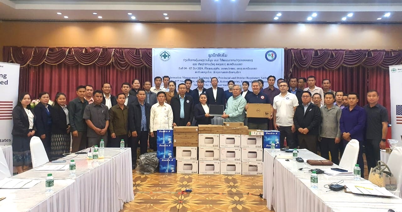
Published on 04/03/2024
...
ອ່ານເພີ່ມເຕີມຂະແໜງ ລບຕ ທົ່ວປະເທດ
ສະຖິຕິຂອງຂະແໜງການ ລບຕ ທົ່ວປະເທດ
716
ຈຳນວນອຸປະຕິເຫດທັງໝົດ
205,541
ພື້ນທີ່ຢືນຢັນວ່າອັນຕະລາຍເປັນເຮັກຕາ
87,864
ພື້ນທີ່ກວດກູ້ເປັນເຮັກຕາ
1,923,316
ຈຳນວນ ລບຕ ທີ່ທຳລາຍ
ອົງການປະຕິບັດງານ
ຄູ່ຮ່ວມພັດທະນາ